North by Northwest
- Capt. Eric
- Jun 17, 2022
- 4 min read
No Hitchcox mystery: We're simply making our way North on the lee side of Vancouver Island.
Easy navigation, with a little spicing up as I decided to zig zag in a narrow passage West of Lasquetti Island on our way to False Bay.

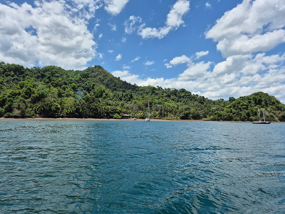
False Bay offered good shelter for the night, and easy access to shore via a public dock for Princess' walks. That's always a winning combination for us.

There was even a cookie shop, but unfortunately we didn't have any Canadian small change.

Our anchorage neighbor was an old beautiful fishing boat converted into a charter boat, "Curve in Time". Looking up their itinerary of cruises and prices at about $1,000 per day per person, there is no doubt Enfin is a much more affordable alternative.

One last morning walk after a peaceful night and we set off for a long passage to Rebecca Spit Marine Provincial Park, in Drew Harbor. The bay is large and well sheltered, with easy shore access via a boat ramp, a beautifully maintained park with restrooms and nice trails. It's also a logical launching point to enter Desolation Sound or the various routes up NOrth to Alaska.
We cruised 52 miles in completely calm waters and clear visibility all the way to the horizon.

We marked our progress up North when we crossed 50 degree Latitude North. Another 4 degrees and 40 minutes to get to Alaska, so it's still pretty far.

We arrived well before sunset this time, and explored anchorage options. At first I tried anchoring close to the town of Heriot Bay, but couldn't find any spot we'd feel safe and comfortable in, so we headed towards nearby Drew Harbor, our original plan.
The bay is huge, with plenty of safe anchorage. Right in the middle was a large 60 meters yacht, with its own support vessel to carry all the toys, as you would.


As we awoke the next day after a very peaceful night, we had full bright sunshine for the next leg.

I had spent a good part of the previous evening calculating and checking when we needed to leave to make it to Beazley Passage in time for slack water. Beazley Passage is in the middle channel on the way to Alaska, and is known for its wild currents up to 12 knots, and more importantly for having a rock in the middle of it that must be avoided.
The Canadian tide book showed slack would be at 12:06, a very decent time that would let us sleep in until a reasonable hour, take Princess ashore and stow the tender back on the boat before the half hour transit to the pass. To be extra safe I decided to arrive about 30 minutes early, which would give us time to observe the situation and time our transit as we preferred.
I did have a weird problem though as my Navionics electronic chart was calculating a slack time of 13:14, well over 1 hour after the official book. Reading more, I found an official text and guide that confirmed that when in doubt a mariner should always use the official book's timing.

So 12:06 it was, and we left in time for 11:36 arrival. On our way we over took a trawler about our size that was clearly waiting for slack time. We stopped and I maneuvered the boat to stay close to the entrance, but not under the influence of the strong current.
At exactly 12:04, the boat that had been waiting arrived on scene. He was followed by another boat about 10 minutes behind so I figured we all had the same information.
Letting the local boat go first, I entered the pass just as 12:06, pretty proud of my calculation. I could see there was still some current in the pass, it hadn't calmed all the way down like it is supposed to do at slack, but I figured that was the best it would get during the large tides, and it didn't look worse than some of the rapids we ran on the Columbia river this winter.
We transited following the first boat. I pushed the engine up to keep good control and steered by hand. A couple of large whirl pools had us heel over and I had to correct really fast in order to keep the boat pointing in the right direction, then later to make sure I went around the rock at the exit.
It felt a little sporty, certainly more than I anticipated. Nothing major, but not something I'd want to make a habit of. Luckily this is supposedly the fastest rapid on our route, so things should be easier from now on?
Di took a video, commented in Spanish for her family. It gives a good indication of how tight the pass is, the current and whirlpools as well as how close we run to the rocks.

Both boats headed to Octopus Bay Marine Park, just a few miles further North, so we hailed them on VHF to share with them the photos we had of their transit.
They came up to visit us once we anchored in Octopus Bay, and we learned that they like to run the rapid about an hour early to have some residual current in it, and that slack time was actually around 13:06. The Canadian Book does not use Summer Time, but as far as I could tell makes no reference to it. Lesson learned! It also means my Navionics charts had the right answer, so from now on I will not hesitate to rely on it as we progress up through more rapids.

Octopus Bay is a large protected round bay with a couple side bays. It is entered via only 2 tiny passages giving it all around weather protection on top of simply magnificent scenery.
We're going to call it home for a few nights before we restart our Northerly push. Still about 360 miles to reach the border to Alaska.


Comments